I had packed everything I needed for the trip on the evening of Fri the 27th of July, and got up early on the 28th, had a quick breakfast and walked out to the car. I turned the ignition...and the friggin GPS wouldn't start. The damn thing had turned into a brick overnight! I had checked the route the evening before, checked battery levels and everything looked good. Now the thing was just not starting up. This TomTom-gps had crashed on me once before, and then I had to wait for a whole month for Mediamarkt to send it in for servicing. I feared the same thing had happened again, and I was not very happy with the prospect of driving to Norway using only paper maps. Luckily, I had discussed the TomTom unit with a colleague the day before, and he had told me that they had a habit of freezing up. You could, in some cases, bring them back to life with a reset to factory settings. I did some frenzied googling and found out that there was a hole for a paper clip to reset the thing in case it had gotten confused. Only... I didn't have a paper clip. Seriously, who keeps paper clips around their house anyway? I rummaged through most of my tools before finding a set of screwdrivers small enough to fit the hole. Luckily, the reset function brought the unit back to life, and I could start my road trip, one hour late. Damn you, modern technology!
The trip through Holland and Germany was fairly uneventful, except for that I picked the wrong weekend to start my vacation. Large parts of Germany were starting their vacation period that weekend, so I ended up being stuck in line for the ferry at Puttgarden for three hours. I spent the evening driving around the countryside of Lolland, Denmark to try to find a place to sleep.
The next morning I drove through the rest of Denmark in a couple of hours before crossing Storebæltsbroen - the second longest bridge in the world. It was weird driving over the bridge and seeing really big ships on both sides of the bridge. Other than that it was a hassle-free way to get from Denmark to Sweden, and I wasn't too keen on being stuck in another ferry line. The drive through southwestern Sweden is long and boring. The roads are of good quality, compared to Germany and Denmark, but they get crappier the closer you get to Norway. In the afternoon I finally arrived at my destination - my parents cabin in Strømstad, Sweden, near the border to Norway. This is 1300 km from my home in The Hague, so it was a long drive.
I met up with my parents and my sister there, and stayed two days. Monday evening I had a nice meal with my uncle on my father's side(Arne), two of my cousins(Marianne and Sigurd) and Marianne's daughter(Sara).
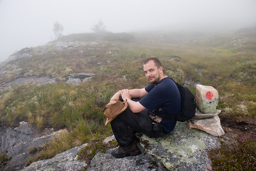
Tuesday the 31st of July I drove to Kongsberg to meet my friend Jan Kristian, dropping of my sister in Oslo on the way. The next few days we went hiking in the Blefjell area north-west of Kongsberg, walking on top of Blenuten in the process. Originally we had planned to go to one of the big peaks of Rondane, but due to bad weather we decided to go to Blefjell instead. It was a nice trip, although slightly windy. Pictures are here.
After a couple of days in Kongsberg, I drove to Lillehammer to stay at my parents' house. I spent a day visiting my grandparents, shopping and preparing equipment. During the weekend I also met up with my brother, who had just returned from climbing the Matterhorn .
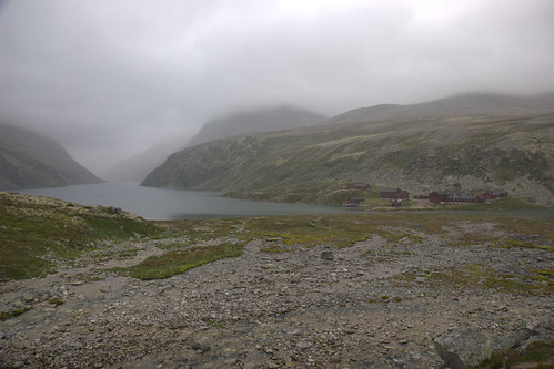
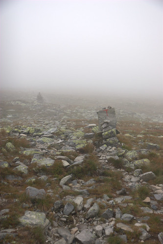
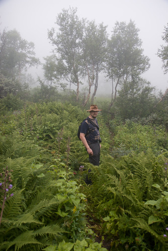
Sunday the 5th of August, the weather forecast looked good, for the first time in days, so I decided to try hiking to one of the easier big peaks of Rondane . After driving for two and a half hours to get to the plateau below the peaks, I found out the weather forecast was wrong. The cloud cover was low, and you couldn't see the peaks. I started walking uphill anyway, thinking that the skies might clear up in a couple of hours. It turned out they didn't. The fog only got thicker, the wind started picking up, and it started to rain heavily. Since I couldn't see anything, and there was no sign of the fog lifting I decided to turn back, three hours up the mountain. Turning back and walking back to the car for hours on loose slippery rock through rain, wind and fog was no fun, but there really was no point trying to climb the mountain in this weather.
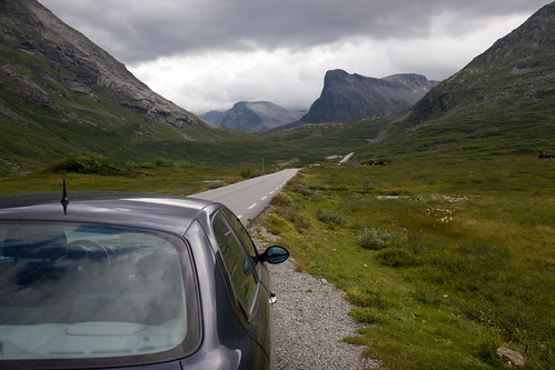
On Monday the weather forecast was better than the day before, so I decided to go to the mountains again, this time to Jotunheimen . I had bought a new book about Jotunheimen while dropping off my sister in Oslo, and this mentioned a mountain close to the roads with a good view of the southern part of Jotunheimen. I drove up there and found out the cloud cover was just as low as the day before, but it was still higher up than the mountain I was going to, Synshorn. I parked my car at the bottom of the mountain and hiked up to the top of the mountain in only an hour. The viewpoint at the top was very nice, and the hike up was really easy, so it was a nice trip. I drove a different way back, taking the scenic route over the mountain back to Lillehammer. Pictures are here .
Tuesday the 7th I spent visiting my uncle and aunt(Liv and Jarle) and preparing to go to Trondheim to visit my friend Håkon Humberset. I got a tip from my uncle about it being faster to drive across the mountain plateau near Ringebu if I wanted to go to Trondheim. This was also the route my GPS unit picked...it turned out it was almost 20 kilometers shorter than the regular route through Dombås. I had never driven this route before, so it was a nice experience. Part of the way I had a great view of some of the big peaks of Rondane, so it was very scenic compared to the regular route.

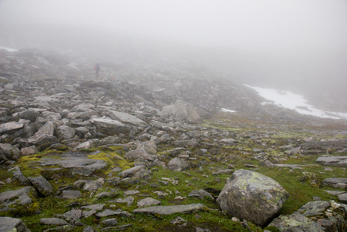
I met up with Håkon in Trondheim, and we planned a big hiking trip into the Trollheimen area. The next morning we drove towards Surnadal, to park my car down at the Kårvatn car park in Todalen. On the first day we crossed the mountain pass at Bjøråskaret to get to Innerdalen. We walked into fairly thick fog near the top, but this was not all that much cause for concern, as I had brought my Garmin GPS unit with me, so we always found our way back to the path. What was more worrying was the amount of snow we were seeing around us, and just below the top of the pass our fears came true: We had to cross a steep snow flank to get across. We were carrying heavy backpacks and we were not carrying ice axes, so if we were to slip, there was a big chance we would slip forcefully all the way into the rocks below and injure ourselves. We walked really carefully up the flank, and fifteen minutes later we had crossed, without incident. The wind was picking up, but the fog was only getting thicker, robbing us of the magnificient view we were supposed to have into Innerdalen from the top of Bjøråskaret. The way down from the pass took a lot longer than we planned for. At the top the trail degenerated into steep piles of rock, and the rocks were very slippery, so we were very careful going down. On the way up to the mountain pass, we had climbed about 900m of elevation spread out over 12 km. Going down now into Innerdalen, we were descending about 800m of elevation in just 2 kilometers, so the path was really steep in places. Not being able to see anything because of the fog was also starting to sap our morale, and the trip was getting a lot longer than we planned for. Eventually, after seven hours of hiking, we found Innerdalshytta, were we spent the night.
The next morning the weather was totally different. The clouds had lifted and the sun was shining, giving us a great view of Innerdalen. We walked the length of Innerdalen, up to Innerdalsporten, over Medskaret and down the road to the Bårdsgården farmhouse. The hike was a bit wetter than we planned for, and we had to make some detours around some of the worst marshes, due to Håkon having brought hiking shoes rather than hiking boots (which is a problem with wet soil). I really liked the first part of the hike. Great view, nice weather, not very strenuous. The three-hour walk down the road to the farmhouse on the other hand was grueling, especially since we knew we had to go back the same way the next day. The placement of the cabin was really bad, and this contributed a lot to our decision to change to a three-day trip rather than a four-day trip. Håkon had developed blisters on his back from the backpack, and he was having a real problem carrying a backpack, so we decided to repack in the morning, stuff all clothes and unneeded equipment in his backpack and leave it at the cabin. We would then go to the car and drive all the way around to the other side of the mountain range to pick up the backpack. We were in a bad mood in the evening, as we were tired and there were no showers available, as the ones that were there were coin-operated, and we didn't have the right type of coins.


Saturday we got up really early and walked along the road up to the trail head. just before hitting the trail, the fog rolled in again, leaving us hiking in the fog. To add to the problems, the trail didn't go where the map said it should go, so the gps wasn't all that useful. The trail markings were fresh, though and easy to follow, so there were no big problems in finding our way. The path was very overgrown in places and it was very muddy down next to the river. We tried to avoid the worst mudholes, but in some areas there were nowhere else to go. I sank in to my knees in some places. Luckily my boots and hiking pants held up, so I had dry feet the entire trip. We had a very long drive back to Trondheim, taking a detour over a very crappy mountain road to pick up Håkon's backpack.
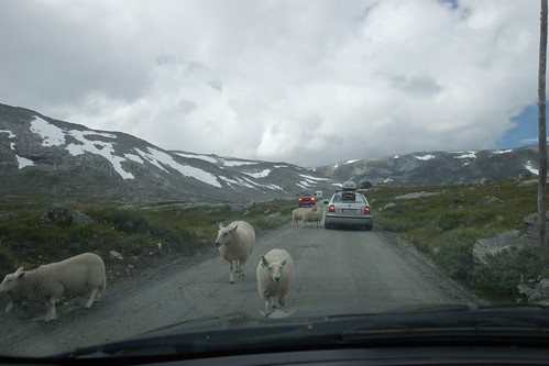
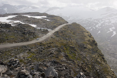
I left Trondheim early on Sunday in order to meet up with my uncle and aunt (Steinar and Liv) and my cousin Ingrid. I spent Monday meeting up with family and resting after the trip. The trip to Trollheimen had been fairly tiring, and I was limping for several days after all the bumps from jumping from rock to rock with a heavy backpack. I decided to put my other hiking plans on hold and do road trips instead. On Tuesday the 14th I drove north from Lillehammer, going to see the wild and mountainous northern part of western Norway. I drove through Lom, up to Grotli, to drive the old road over Strynefjell, which is a road now only used by tourists. This was a very narrow, winding mountain road way up in the mountains. I built up a healthy hatred of camper vans up there, as it is difficult to pass them when they come the other way. I had to position my car at the very edge of the road and in some places you ran the risk of sliding off the road, so the drive was somewhat stressful. It's probably better outside the main tourist season when you don't meet so many other cars.
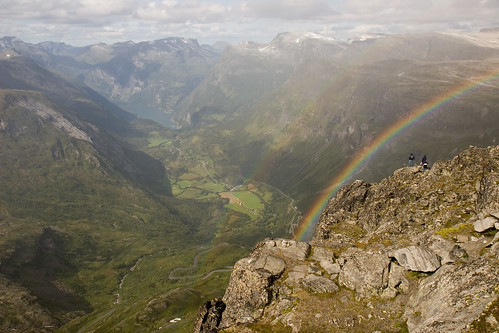
I took the new road through the tunnels back towards Geiranger, and took a detour towards Dalsnibba. This is a mountain which has a great panoramic view of the area around Geiranger, and there is a nice viewing platform at the top. To get up there you have to drive a winding, steep road. The road is missing guardrails in some places, so it feels exposed, but the road itself is quite wide, compared to gamle strynefjellsvei . There could be a problem if you meet a bus in a hairpin bend, though.
I drove down all the hairpin bends to Geiranger, stopping to see the view from Flydalsjuvet on the way. Luckily there was a room available at Hotell Union, so I didn't have to spend a lot of time finding a place to sleep. I spent the evening walking around Geiranger. Geiranger is one of the top tourist destinations of Norway, and is classified as a Unesco World Heritage Site. There's nothing there except camping sites and souvenir shops, so spending more than a day there would be boring. Pictures are here.
The next day I left to take the scenic drive over the mountains towards Trollstigen.

I found this drive very interesting. Lots of nice mountains to look at on the way. It was pretty crowded around Trollstigen, though, with busloads of tourists going up and down the narrow road. I found that Trollstigen wasn't as narrow as the rumors would have it. The only problem was that it had a lot of traffic, with buses going up and down all the time, so I spent some time waiting for buses to clear the hairpin bends. I went back through Romsdalen, making a quick stop at Trollveggen . The weather was really bad, heavy rains and near gale-force winds, so driving back was tiring.
The next day I drove down to Kongsberg to meet up with Egil Rugland and Stein Gjøen, two friends from back when I was working for Kongsberg Defence & Aerospace. We had a nice dinner, and talked the whole evening. Friday I drove to Oslo and took the ferry towards Kiel. I traveled on the Color Fantasy (not as good as it sounds). Saturday I arrived in Kiel, and drove the 6,5 hours back to The Hague.
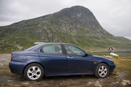
To sum up, I managed to do most of the things I planned, so it was a good vacation. There was a lot of driving, though. In three weeks I drove 5200km. Good thing the car held up...
1 comment:
Thanks for very nice report from vacation! Very nice style again!
Post a Comment