I had been on a business trip until 20.00 on Friday, so I was very busy packing. I had made a list up front of what to pack, but I had a hard time finding some of the things, so I tore up my apartment trying to find the last items. As I came back late, I hadn't had time to check into my flight early, so when I tried to check in online in the evening, the website told me I was on "Standby" to go to Norway, which meant that I risked being pushed to the next flight, 12 hours later. I wasn't really looking forward to spending the day at Schiphol, so I was pretty pissed off when I went to bed. I was very stressed out when leaving at 06.30 in the morning.
Arriving at Schiphol in the morning, checking in, it turned out they had upgraded me to business instead. My KLM silver card had struck again! Unfortunately, on the flight over, the baggage handlers broke my backpack, so I had to spend some time in Lillehammer buying a new backpack.
For the next couple of days, I was mostly spending time with my brother and sister. I checked out bus schedules to go into the mountains from Lillehammer. Unfortunately they were kind of sucky. For some destinations it was like one bus per day, and sometimes I had to spend the night at some village in the mountains. Luckily I managed to borrow my grandfather's car, so I avoided all the suckiness that would have ensued from using the buses.
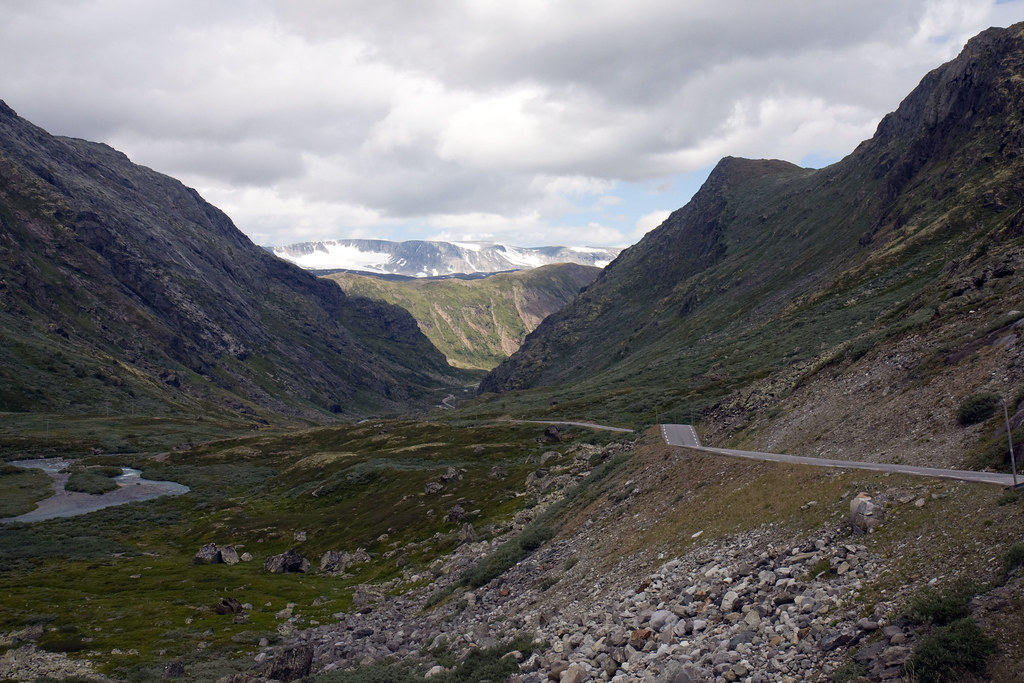
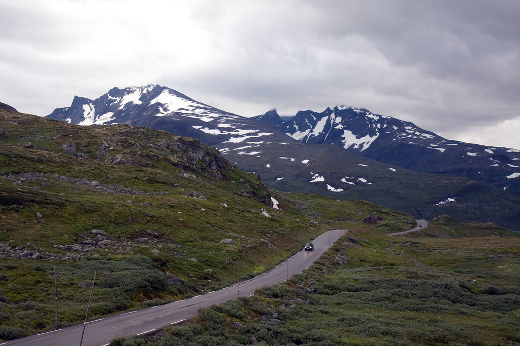
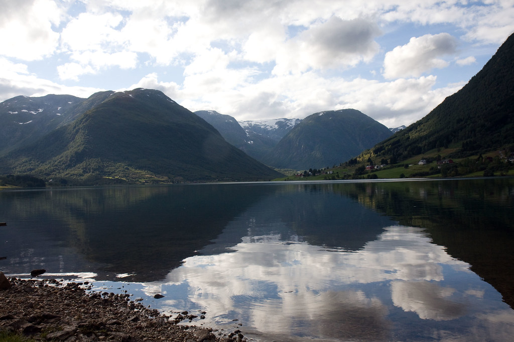
On Wed 6th I drove into the mountains, going to one of the most scenic roads in Norway, called "Gamle Sognefjellsveg" which is the traditional route from Eastern Norway to western Norway over Sognefjell. This drive goes next to the national park "Jotunheimen", literally over the roof of Norway, next to the biggest peaks in Norway, Galdhøpiggen, Glittertind and Hurrungane. My plan was initially to go to the Turtagrø hotel in the mountains, and go hiking in the valley next to the Hurrungane mountains, but when I came up there, the weather was rainy and foggy, so I decided to keep going to the end of the road, descending into Sognefjorden. The weather was much nicer to the west of the mountains, and I spent the evening driving next to the fjords, spending the night in Stryn.
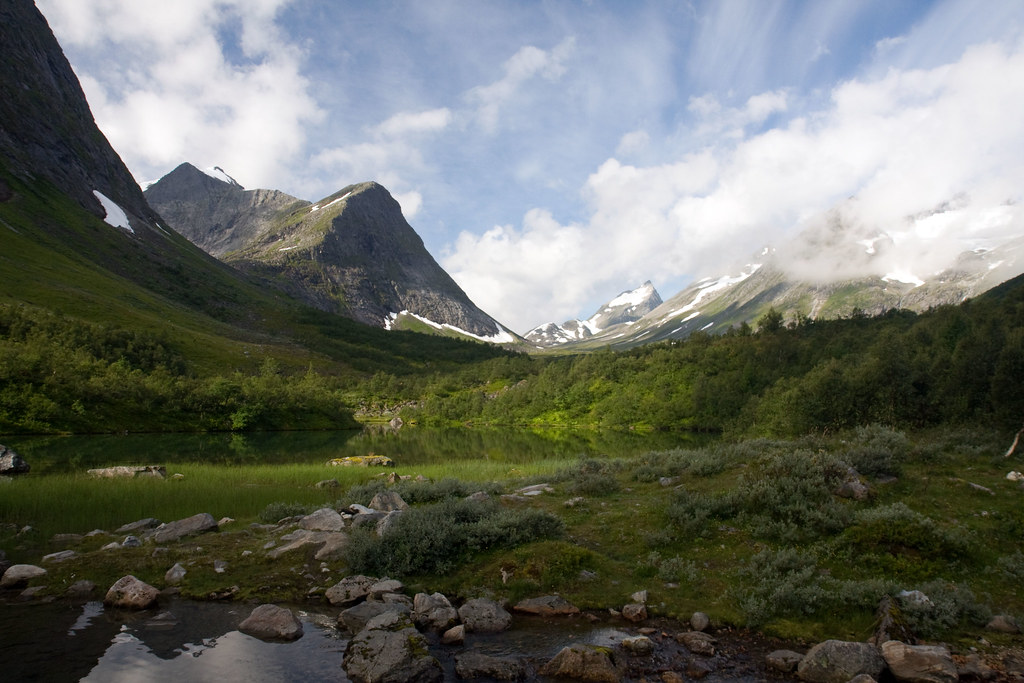
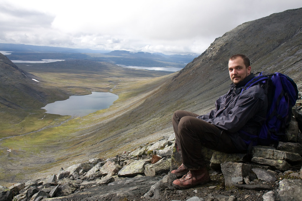
The next morning I got up at 06.00, driving north towards a mountain area called "Sunnmørsalpene" which is really spectacular. The mountains aren't that big, but they're really pointy and shapely, and they go straight up from the fjords, so you almost always have a spectacular view. You get to go hiking by the fjords, yet you are still in the mountains. I was fairly lucky with the weather as well, so I was pretty happy hiking up a valley called Habostaddalen, close to Stranda (a bit further down the fjord from Geiranger). I hiked the length of the valley and the first three hours or so I was alone up there,so I had a really good time hiking. On my way back I met lots of people going up Slogen, which is a very popular peak in this area. I spent the rest of the day driving back, going down Trollstigen again, driving back through Romsdalen before going back down Gudbrandsdalen to Lillehammer.
Friday I left by train for Oslo, going down to visit Marcus and Olga, and to go to Øystein and Ingvild's wedding on Saturday.
I spent the next couple of days meeting up with the rest of my family.
Tuesday I had decided to do the Besseggen hike. This is the most popular hike in Norway, and every year around 40.000 people walk this ridge. I had planned to go there last year, but then the weather was too windy.
This year, though, the weather prognosis was OK, so I got up at 05.30, got myself a big cup of coffee and drove the three hours up to the parking lot at Gjendesheim, in the Jotunheimen national park. I almost hit a moose on my way up, but other than that, it's a nice drive up there. I always like driving the Valdresflya road, as you really feel like you're driving in the mountains.
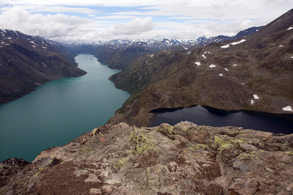
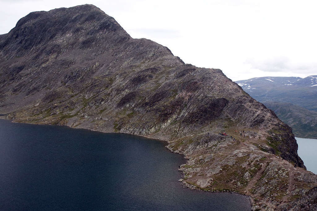
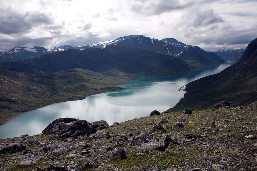
I got on the 9.45 boat to Memurubu, where the hike begins. This is the base camp for the Besseggen hike, but also for people going to the giant Surtningssui-peaks, or simply for people walking cabin-to-cabin (popular vacation variant in Norway). After a couple of kilometers of steep walking I was up on the ridge, having a really spectacular view of Gjende, and the peaks of the other side of the lake. After about two and a half hours of walking I got to the ridge itself. It looked less scary from close up, so I was having some trouble figuring out what the fuzz was all about. I was about to find out, though. About 2/3 up the ridge, it suddenly becomes dramatically steeper, so you have to use your arms as well as your legs to get up there. I'm fairly short, so I also had less options for where to put my legs, so I spent some time figuring out where to climb. I'm afraid of heights, so I was a bit anxious before walking up there, but while I was doing it I was all focused on climbing up in the most efficient manner, so I wasn't all that scared going up there. Slightly elevated pulse, but not really a problem going up there. I suppose that trip to Catinaccio in Italy last year really helped a lot in redefining what feels scary to me.
After I got to the top, the rest of the hike was really boring, except for that you have a nice view of Gjende on your way down, of course. Driving back to Lillehammer, I decided to do what my new Navigon GPS told me, so I got a really strange route going back on dirt roads across the mountain. I suppose the map data for Norway was poor with this model GPS, and that was why it was having trouble distinguishing between paved and unpaved roads.
Wednesday the 13th I drove north towards Trondheim, to go visit my friend Håkon. As I reached the end of the hills going up Ringebufjellet, an alarm bell in my grandfather's car went off, and the temperature gauge was all the way up. Turns out there was no coolant in the tank or the radiator. Luckily I had brought a liter of pure water, so I poured that in. I stopped at a store at the top of the mountain and got a bottle of concentrated coolant to mix with the water, and after bleeding air out of the system, the car was OK again. I learned my lesson about checking for coolant before going on long trips, and the whole incident only cost me an hour or so of driving time.
I spent the evening at Håkon's place, watching movies and some tv series on his 120" projection screen.
The next morning we drove southwards toward a mountain area on the border called Sylan(Sylarna in swedish). Unfortunately, the weather was really bad, foggy and rainy, so we didn't do all that much hiking the first day. We walked for three hours, crossing into Sweden and looking at some grouse and reindeer on the way, before going back to the mountain cabin Nedalshytta for a dinner of mountain trout from the lake below.
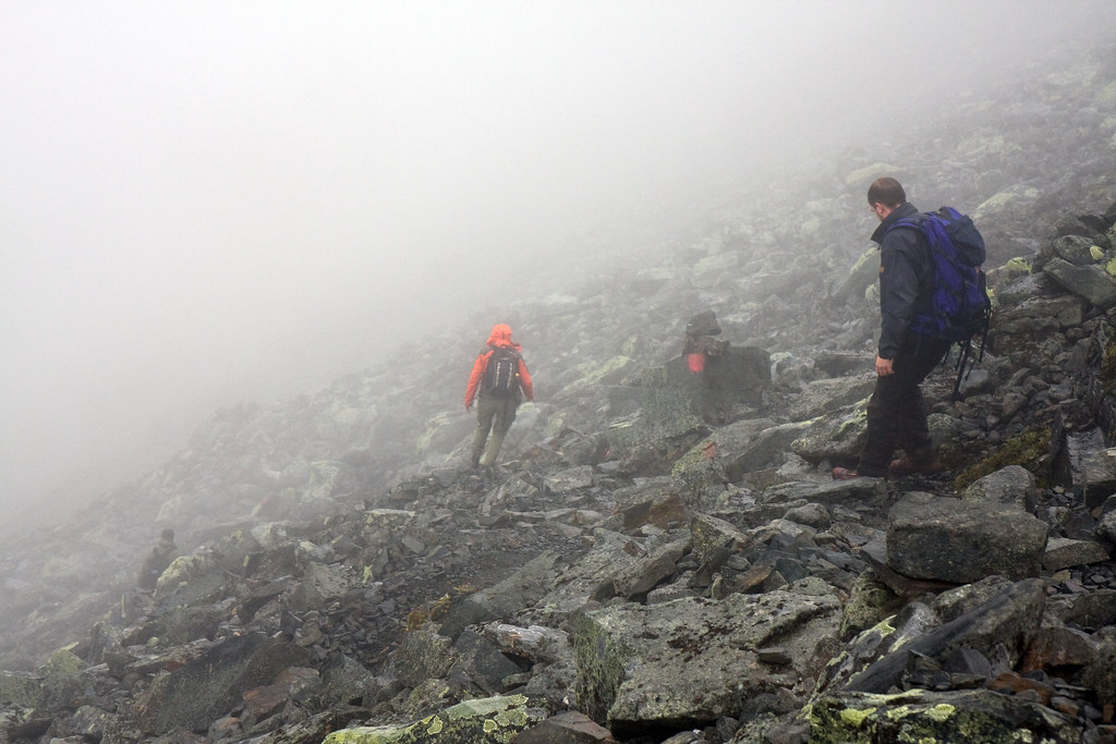
Friday morning we started off towards the biggest peak in the area, Storsylen. Unfortunately, the trek up there was very wet and marshy, partly because of all the rain the previous day. After two and a half hours we reached the base of Storsylen, and stopped to stare in disbelief at where the path was going. It seemed to go more or less straight up the mountainside. We also saw other hikers, and confirmed that yes, indeed, the path was straight up there.
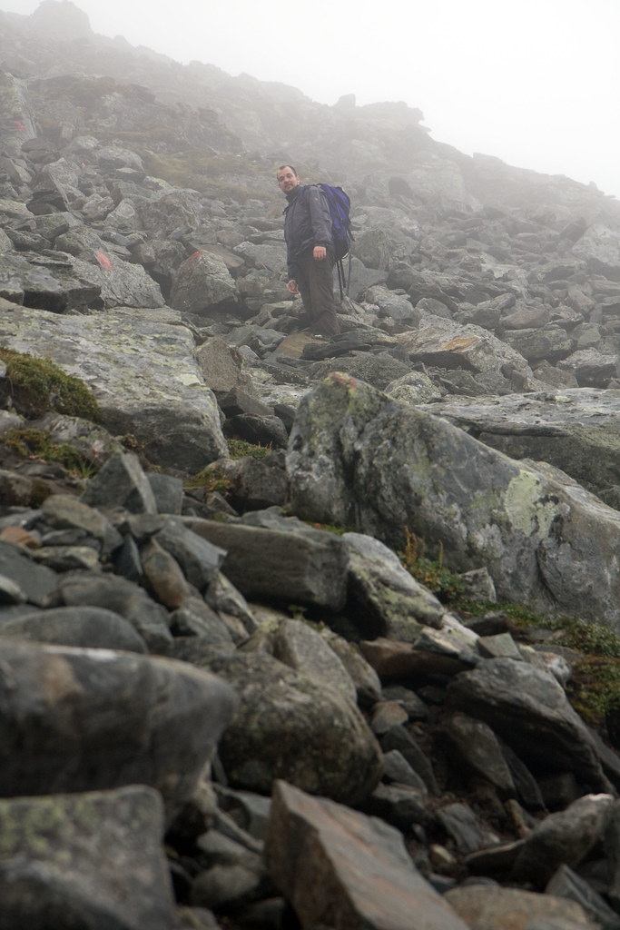
We were both fairly out of shape (All the exercises and vacationing this spring/summer screwed up my workout cycle), so we really struggled going up there. We had to take plenty of breaks to catch our breath up the steep slope. The path ascended 700 meters in less than a kilometer, so it was almost 45 degrees inclination in places. To top it off, because of the rain the day before, the rocks were really slippery, so we had to be careful not to slip and hurt ourselves. The top of the mountain and the ridge leading up there was shrouded in mist, but we hoped it would lift by the time we got up there. The weather forecast said "Sunny after 12:00" so we hoped for the best. Unfortunately, it did not lift until we were well on our way down.
The ascent was very strenuous, but our spirits lifted as a gust of wind cleared away the fog for a brief moment so we could see the top ridge. The top ridge was every bit as wet as the ascent, so we were very slow and careful finding a safe route up to the top. The annoying thing was that there was a perfect route to the top, but it would require you to walk within one meter of the edge, and with a drop of several hundred meters we were not very keen on going there. The top had a log book where you could write your name and the date, so we did the obligatory "Klaatu! Verata!" etc. before picking up the book and writing our names.
It started raining more while we were on the top, so the descent was downright scary. We spent probably twice as much time going down the top ridge as we did going up, and still we had a couple of almost-slides. Down at the bottom we were glad to get down without breaking anything. And...of course the freaking fog cleared up as we were halfway down the mountain. We walked the two hours back to the car, looking at reindeer along the way before driving back to Trondheim.
Pictures are here
No comments:
Post a Comment